
VMAP covers most commercial real estate properties — color-coded by property type so you can read a market at a glance.
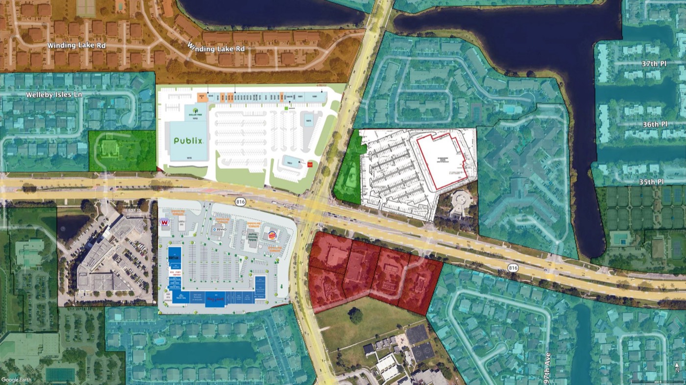 Sunrise · Broward County, FL
Average daily traffic at major roads and intersections — directional counts where the DOT reports them, multi-year history where it's available. Site selection's first question, answered without leaving Google Earth.
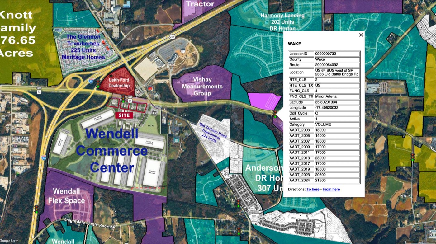 Wendell · Wake County, NC
Most centers are highlighted and many carry site plans, anchor tenants, and their square footages — color-coded by property type, so the market structure jumps off the map before you've pulled a single flyer.
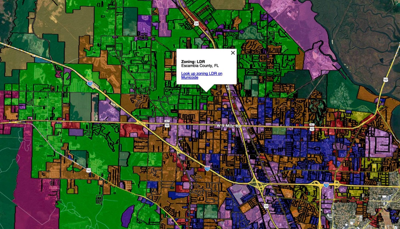 Escambia County, FL
Color-coded districts with the code's meaning right in the balloon — and every district links to its Municode ordinance. From "what's that zoned?" to reading the actual regulation in two clicks.
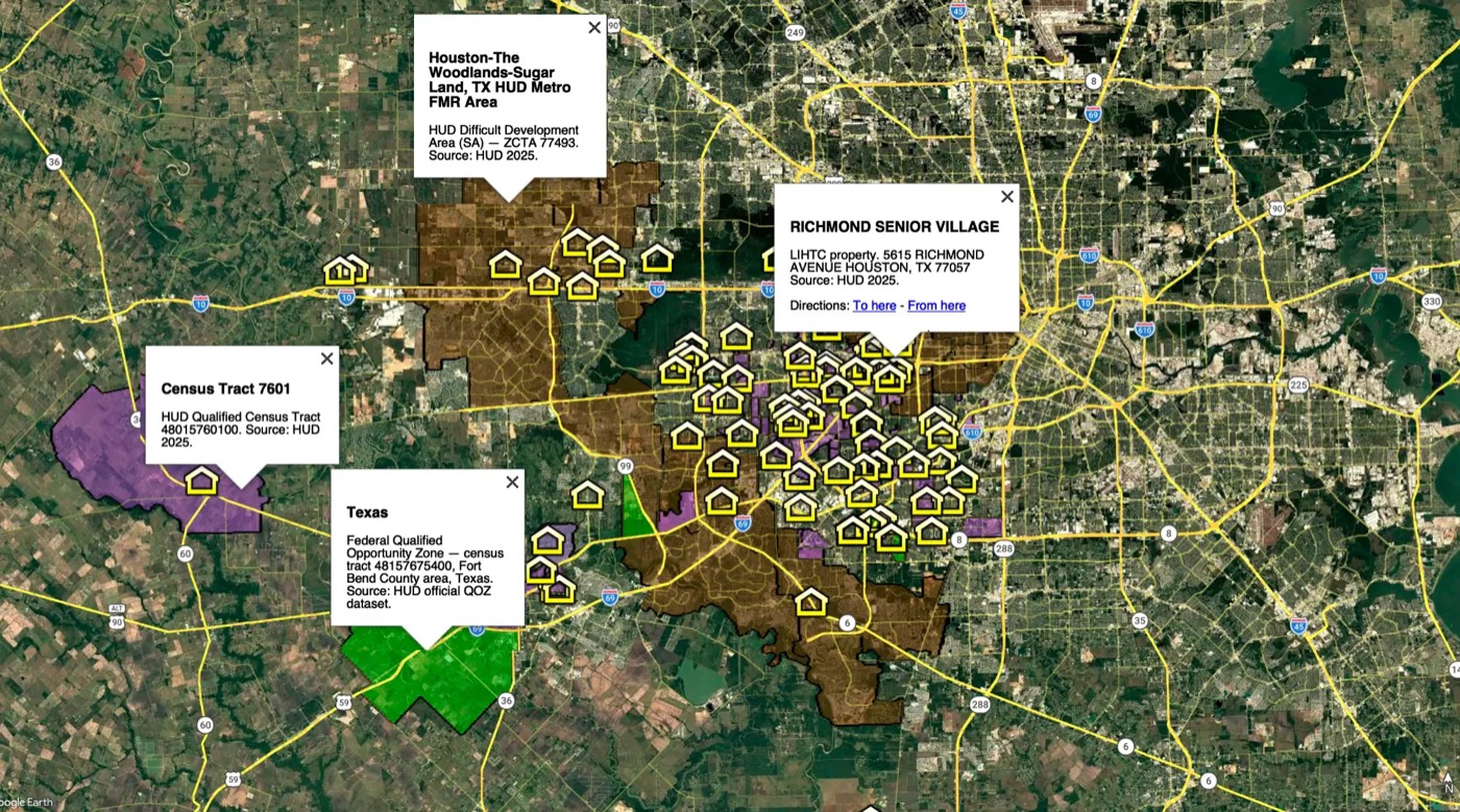 Houston, TX
Incentive districts layered right over the parcels — federal Opportunity Zones, HUD Qualified Census Tracts, Difficult Development Areas, and LIHTC properties, each a click away from its source data.
County GIS departments, city zoning maps, FEMA, HUD, and the U.S. Census — not scraped listings. The same records the jurisdictions themselves publish.
Zoning districts link to their Municode ordinances; incentive districts link to their federal source data. Verify anything in one click.
Every layer opens right in free Google Earth — free base layers instantly, premium layers live on the map the moment you start Pro.
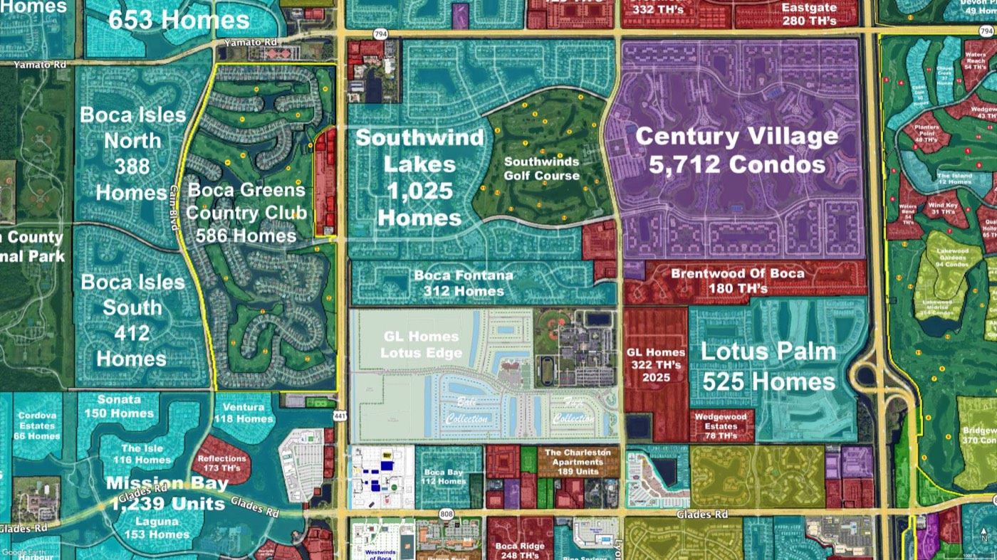
Every residential layer is built around a question real buyers and agents ask every day — school zones, neighborhoods, shelters, precincts. One click in Google Earth, and the answer is on the map.
“Where will my child attend school?”
Find the elementary, middle, and high school attendance zones — and see every neighborhood that feeds into those schools.
“How do I get to know my area?”
Single-family communities, condos, townhomes, apartments, country clubs, and 55+ — instantly viewable. Perfect for listing presentations and research: show clients you know the area better than anyone.
“Can I only see the neighborhoods that fit?”
Unlike the MLS or Zillow, eliminate every neighborhood that doesn't fit — school zone, townhomes, country clubs, 55+ — instantly with one click.
“Which city is this property actually in?”
See exactly where every city begins and ends — including unincorporated areas. A mailing address doesn't always match the real jurisdiction, taxes, or services.
“Where do I go in an emergency?”
Every emergency shelter plus evacuation-zone boundaries — so you know whether a property has to evacuate, and where to go if it does.
“Who are my government representatives?”
One click shows the Congressional, State House, and State Senate districts — and the people who hold those seats.
“Where do I go to vote?”
Every voter precinct with its polling location. Find your neighborhood on the map and your polling place is one click away.
“Where are the bus stops near me?”
Every stop with its exact location — plus whether it's sheltered, has a bench, and has a bike rack.
“Does this home have to evacuate?”
Every evacuation zone drawn right on the map. Know a property's zone before the storm ever forms — and when that zone gets the call to leave.
Every county starts free. Pro unlocks every premium layer, live on the map, for one flat subscription.
See Pricing →